Our Country
Come and explore this amazing Country we belong to. Our place has spectacular beaches, estuaries, forests and farmlands. People here are creative, energetic and care about Country. Visit our significant sites through photos, stories and our interactive map. Bush rules here will help you care for Country. Let’s go exploring!

The place we call Cavanbah, now known as Byron Bay and surrounding district are located in the Northern Rivers region, the northeast corner of New South Wales, Australia.
It’s about 750 kms (480 miles) north of Sydney and 165 kms (103 miles) south of Brisbane.
Walgun headland, known as Cape Byron, is the easternmost point of mainland Australia. Cavenbah has always been an important meeting place for the Arakwal, neighbouring clans and people of the Bundjalung nation.
Arakwal Country extends from Seven Mile Beach, south of Broken Head, to the Brunswick River up north, out to the escarpment west of Byron Bay, and east out into the Tasman Sea.
Binungal!
Stop! Look! Listen!
Bush Rules on Country.
By being on Country watching, listening and learning – we can get to know this Country, respect and use it wisely, and understand how to look after Country.
When we are in Country we follow some basic bush rules and we invite you to follow them too, especially if you are visiting our cultural sites.
- Absorb what is around you and keep voices to a minimum
- Keep to tracks and leave plants and animals where they are
- Where fishing is allowed only catch what you need
- If you find one of our middens please don’t touch them
- Please respect our sacred sites if you know them or where they are
- Remember to look after country so that it can look after us
Our Totems
A totem is an animal, plant, another natural object like rock, river or tree that is connected to a person ancestrally. It can have an emblem such a wooden pole or decorated object to represent it.
Much of our art is connected to and reflects the power of totems and how they are connected together in the story of life.
A totem connects us to Country, to each other and the Dreaming. In nature all creatures and objects have their place and importance, and so do we in our community and in our relationship to Country.
By being connected to totems and what they represent we individually and collectively share responsibility for each other and Country. In this way we each make sure that we don’t do wrong by Country, that we look after Country, and it will look after us.

There are totems that link us together as women and as men, as a clan or land-connected unit, and as a bigger tribe of people living in Country.
Each of us is given an individual totem that we need to learn about and understand, and help protect and maintain for the future. In this way we all play our part in respecting and caring for Country.

Carpet Snake (Kabul)
We are the carpet snake people. Carpet Snake (Morelia spilota) as one of our key totems symbolises the relationship of clan members to each other, to our ancestors and the past, and to particular places or sites.
Carpet snakes are important to us for their conservation, wild resource and other cultural values. Kabul is not venomous despite its ability to reach up to 3.5metres in length!
You can recognize Kabul by its thick body and its skin pattern of yellow and black patches. If you see one in gardens or in the bush, admire its beauty and leave it alone as it is special to us.

Dolphin (Wajung)
Bottlenose Dolphin (Tursiops aduncus) is an important totem for our people, especially our women.
Wajung gives us messages about relationships between our clan members, to our ancestors and the past, and also to particular places and sites in our Country. We have stories of our people and dolphins communicating and connecting with each other, including co-operative fishing, sharing resources from the ocean, and playing in the shallows.
There are around 1000 resident and transient Bottlenose dolphins using waters surrounding Byron Bay to feed, play and breed. They can live for over 50 years, so many of them know the sea country well!
You can spot Wajung most days from Cape Byron Headland (Walgun), The Pass and other beaches as they surf the waves of the Bay, and swim along the coast and into estuaries to feed and explore in their ‘pods’ or social groups.
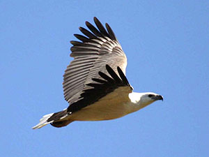
Sea Eagle (Miwing)
White Breasted Sea Eagle (Haliaetus leucogaster) is an important totem for us, especially our men.
Miwing gives us messages about clan and family groups, provides knowledge on hunting practices and environmental events on Country. The second largest raptor (bird of prey), you can see majestic Miwing soaring above you as you walk along Tallow Beach or around the Cape.
Miwing forages in creeks and adjacent coast for eels, fish, sea snakes, crustaceans, small birds and mammals. Keep your eye out for Miwing’s nest – a large pile of sticks either on the ground, in a prominent tree, or on the coastal cliffs.

Brush Turkey (Wollum)
Brush Turkey (Alectura lathami) is a messenger providing clues about and demonstrating knowledge and adaptability in knowing and using Country.
Wollum likes to live and move freely in the coastal bush, foraging through leaf litter for fruits, seeds and small animals to eat. The male builds large mounds out of vegetative material and uses it to incubate their eggs.
They also live and scavenge in many urban backyards and picnic spots around Byron Bay (Cavanbah) so you might see them anywhere!
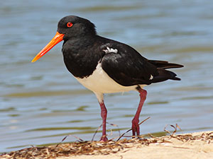
Pied Oystercatcher (Bijahlin)
Pied Oystercatcher (Haematopus longirostris) is an important bird to us because they provide messages about food sources and environmental events in Country.
The Pied forages on the beaches and rocky shores, in mudflats of inlets, bays, ocean beaches, and on the offshore islets. What a striking bird they are with their long orange beak, black and white body, and their piercing call when they are disturbed and fly off from where they are foraging.
The Pied is classified as an endangered species of NSW with only a relatively small number of breeding pairs. Belongil Spit is an important nesting site for the Pied, and chicks and fledglings can be spotted there.

Turtle (Binguing)
Turtle (Chelonia species) is an important messenger that provides knowledge of the sea Country.
Binguing nests on north coast beaches including Tallow Beach and Lennox Heads to the south. Julian Rocks (Nguthungulli) supports significant populations of the Binguing and if you go snorkeling or diving there, you can have a close encounter with these graceful creatures.
Surfers and swimmers as well as those visiting the Cape often catch a glimpse of Binguing coming to the surface for air in the Bay. Binguing should be respected, and are classified as a vulnerable species in NSW.
Native Title
The Bundjalung of Byron Bay Arakwal People have lived in the coastal landscape around Byron Bay for at least 22,000 years.
The Arakwal Elders Lorna Kelly, Linda Vidler and Yvonne Graham made the first Native Title Application on behalf of the Arakwal people in 1994, not long after the historic ’Mabo’ High Court decision in 1992.
Since this application, and over the next 15 years, three Indigenous Land Use Agreements (ILUA) were negotiated with the State of New South Wales.
Significant Sites
We are strongly connected to our Country and it to us. The Dreaming made the land and gave us the land. Song-lines and stories identify and link places and events in the Dreaming, helping us to understand their interconnected value and show respect. These places are often called significant or sacred sites.
Some sites are special because they relate to women and men’s business or activities, or to animals and plants and their maintenance, others because they are meeting places or places of sustenance for us all. Some are special because they feature strongly in our Dreaming which explains our past, present and future link to land and sea Country and to each other, both around here and further away. Sites can link us to our ancestors and they connect us to the land. They help a person feel strong about where they came from. We can live elsewhere but this is where we belong and so its important to know and understand these significant sites so that you can walk around with pride.
Here are some signficant sites to look for and to understand. These can be shared with everyone and need to be respected. Many others are known only to our law holders and elders, or where knowledge has been passed on within our community for us to protect and look after them. In this way our culture can be resilient and prosper into the future.
Three Sisters Rock
A Dreamtime story of the Three Sisters Rock (also known as Two Sisters) tells of three sisters swimming off the headland at Broken Head.
The youngest sister swam out and became caught in a treacherous current flowing between the rocks. Her older sisters swam to save her but were also swept out.
The three of them became exhausted fighting against the current and drowned, becoming the rocks that carry their name.
Bundjalung people tell this story as a warning to their children, that if they swam there, they too might drown and turn to stone.
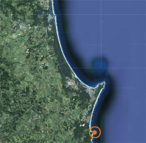
Brays & Whites Beach
Located just south of Broken Head these picturesque cove beaches backed by forest covered cliffs were used for hunting and camping by our people.
Brays Beach is named after the Bray family, one of the orginal Arakwal families living in the area when Cumbebin (Byron Bay) was colonised by European settlers.
‘King’ Bobby, his son Harry, (who later inherited the title from him) and their families often hunted and camped in the area that is now part of the Broken Head Nature Reserve.
There are still the remnants of a hut at Brays Beach where Lorna Bray (Harry’s granddaughter) lived for some time with her family into more recent times.
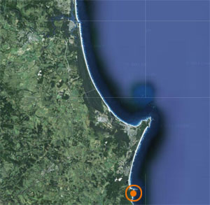
Tallow Creek
Tallow Creek includes small lakes and wetlands and is located south of Cumbebin (Byron Bay) behind the dunal area along Tallow Beach and flows intermittently into the Pacific Ocean. “This is our stomping ground as you’d call it” (Aunty Linda Vidler).
This is where Arakwal Elders, Dulcie Nicholls, Lorna Kelly (dec), and Linda Vidler (dec) were born and lived with their parents for much of their youth.
This is our stomping ground as you’d call it. We live just up the hill up here. And this area, we used to come for our natural food: fish and crabs and eels, in this little creek here. In the morning before the birds got here, we used to come and get prawns by our hands, because we lived naturally, and we just took what we wanted for a feed. Every day we’d come down.
Elder Aunty Linda Vidler

Currenba
Currenba is located at The Pass a sheltered beach popular for picnicking, surfing and boating access to the Bay and beyond.
It means ‘gully’ and refers to the natural water channels found in this forested area. Currenba is a significant place for us.
It was a special home base and meeting place for the Arakwal people and other tribes from the Bunjalung Nation. They camped in the beautiful Palm Valley and ate pipis, fish and other abundant sea tucker, which they caught at the Pass and Wategos inside the Bay.
The surviving midden and campsite at Palm Valley is the oldest of its type in the region, estimated to be approximately 1,500 years old.
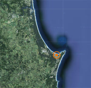
Cavanbah
Cavanbah, which means ‘meeting place’, with its sweeping beachfront and sheltered places was a favourite home base and meeting place for the Arakwal people and other Bunjalung nation tribes.
Today it is the township of Byron Bay. In 1881 when Europeans first arrived, ‘King’ Bobby, an important Arakwal ancestor was the leader of a large group of around 80 people in Cavanbah.
The home camp was located near the current crossroads of Lawson and Fletcher Streets in the Byron Bay CBD, not far from the site of the old Council Chambers. When ‘King’ Bobby died, his son Harry Bray inherited the kingship.
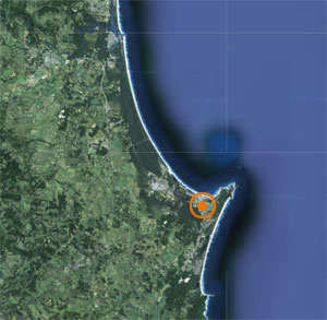
Cumbebin Swamp
Cumbebin Swamp is located adjacent to the township of Byron Bay and is connected to Belongil estuary. It is an important part of Country for the Arakwal people as a place of plenty supporting sustainable living.
Cumbebin wetlands are homelands where hunting and gathering occurred associated with separate men’s and women’s business.
Men would go to the swamp to catch food such as birds, eels, turtles and snakes. Women would gather bush tucker and materials from the swamp including ferns for making baskets and paperbark to build their homes.
Cumbebin Swamp is now a Nature Reserve jointly managed by the Arakwal community and NSW National Parks and Wildlife Service under a co-management agreement.
Nguthungulli
This group of small islets out in the Bay are very significant to us. It is also an important habitat area for Binguing (turtle), many species of fish some which are endangered such as the Grey Nurse shark. There are several important Dreaming stories associated with Julian Rocks.
In one story, Nguthungulli, Father of the World, who created all the land and the waters, the animals and plants, now rests in a cave at Julian Rocks. The Elders have instructed over the generations that Nguthungulli must be protected from any misuse or it will cause destruction.
According to Elder, Yvonne Stewart, Nguthungulli was used by Arakwal people in ceremonies when the ocean water levels were lower 7000 years ago and it was accessible land.
Today ‘the Rocks’, as they are often affectionately called, are a key protection zone of the Cape Byron Marine Park, and visited by many people for diving, snorkelling, photography and research purposes.

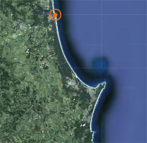
Brunswick River
The Brunswick River (known as Durrumbil) and associated wetlands, saltmarsh and coastline near its mouth were considered a place of significance for our people and the Bunjalung nation. It was a special meeting place for ceremonies and trade purposes.
There was a steady source of food such as dugum (pipis), julum (fish), oysters, bird eggs, land based animals and other bush tucker which could support large numbers of people for months at a time.
Leaves from Foambark (Jagera) trees found in the forest near the river were used for hunting. They released a mild poison when prepared and released into tidal pools stunning fish and causing them to float to the surface, which made them easy pickings.
Middens are common around Brunswick Heads, although sandmining from 1930 onwards unfortunately destroyed many of these. Those remaining are important cultural sites and need to be protected.
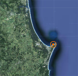
Walgun
The eastern most part of Australian mainland, Walgun plays an important role in many Dreaming stories, and was a special place for ceremony, learning and spiritual inspiration.
Due to its elevation and panoramic views, Walgun, which means ‘the Shoulder’ also played an important strategic role as a lookout point.
A ‘dancing circle” is believed to have once been located on the crest of the headland, which was leveled in 1899 to make way for the construction of the Cape Byron lighthouse. This circle was used in initiation ceremonies for boys.
It is still a powerful place today and visited by many people who are attracted to this energy and the expansive views of Country and our important totems like Miwing, the sea eagle, who soars around Walgun; and Wajung, the dolphin, who swims in pods around Walgun and into the bay.
