Learm more about this artwork

Where is it?

.
Come and explore this amazing Country we belong to. Our place has spectacular beaches, estuaries, forests and farmlands. People here are creative, energetic and care about Country. Visit our significant sites through photos, stories and our interactive map. Bush rules here will help you care for Country.  Let’s go exploring!

'Cavanbah' The Bay. P.Cuming, 2010
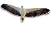
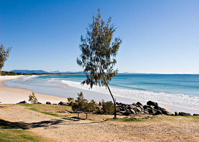
The place we call Cavanbah, now known as Byron Bay and surrounding district are located in the Northern Rivers region, the northeast corner of New South Wales, Australia.  It’s about 750 kms (480 miles) north of Sydney and 165 kms (103 miles) south of Brisbane. Walgun headland, known as Cape Byron, is the easternmost point of mainland Australia. Cavenbah has always been an important meeting place for the Arakwal, neighbouring clans and people of the Bundjalung nation. Arakwal Country extends from Seven Mile Beach, south of Broken Head, to the Brunswick River up north, out to the escarpment west of Byron Bay, and east out into the Tasman Sea.

Click Here to see a dynamic map which shows you where we are. Move your cursor from the centre of the map to the left or right to see our location – in the state of New South Wales, in Australia, and the Asia Pacific region.

What’s here

Walgun & healthlands P.Cuming 2011
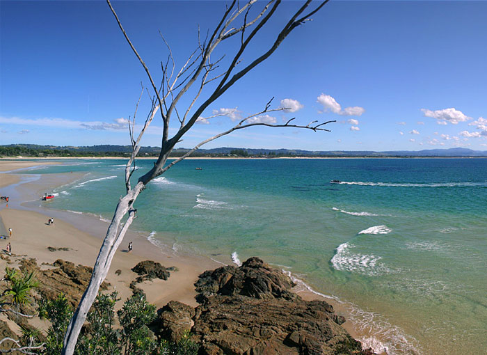
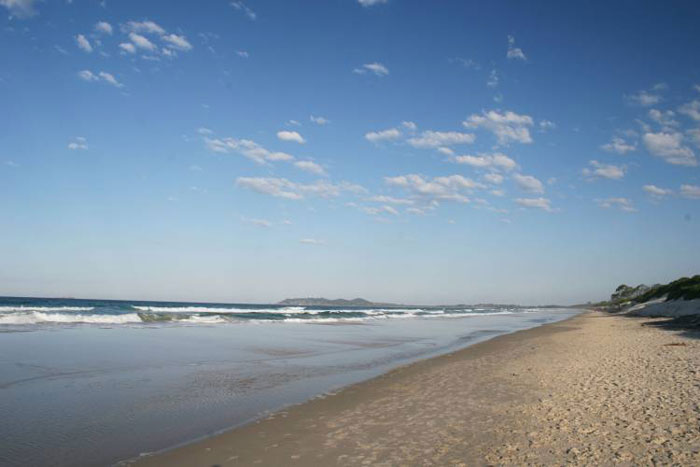
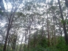
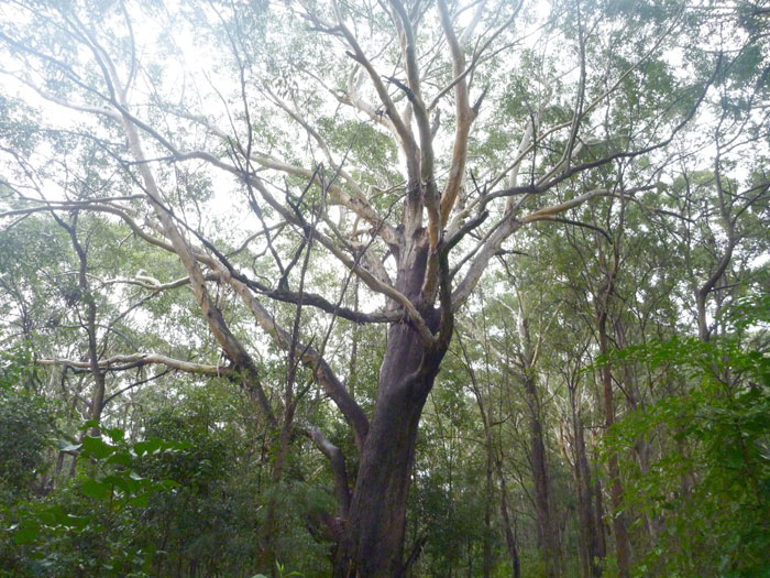
Cavanbah and its hinterland are part of an erosion caldera of an ancient volcano which erupted 23 million years ago. Mt Wollumbin, the volcanic plug of this caldera and a sacred place to many Aboriginal tribes of our region, can be seen from many points in Cavanbah (Byron Bay) and on Walgun (Cape Byron, pictured here to the right). The hills and valleys of volcanic soils and their creeks come down to wetlands and estuaries lying behind long sweeping beaches, protected bays and coves with their rocky shores, and dunal systems covered in flowering heathlands and forests. These are home to many species of animal, birds, fish, amphibians and reptiles.

These include shellfish, many fish species, sharks, dolphins, whales, turtles and dugong; eagles, pelicans, seabirds and waders, pigeons, parrots, honeyeaters and many other colourful birds; wallaby, echidna, possum, native rodents, flying fox and other small mammals; snakes, goanna, lizards, frogs and more! They are all special to us and part of our stories and connection to this wonderful Country.

Out to the Caldera from the Bay P.Cuming, 2011
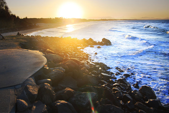
Cavanbah has a sub-tropical climate with hot wet summers, and cool generally dry winters with clear skies and maximum daily temperatures around 20C. This climate is beneficial for all year round outdoor living. High annual rainfall regularly feeds local waterways and productive volcanic and alluvial soils. Combined with rich food sources linked to the coastal forests, estuaries and wetlands our people were able to live here permanently for thousands of years, and support visitors when they came as well to Cavanbah (meeting place). The same applies today with relaxed outdoor living and tourism attracting people to live and holiday here from all over the world.

“Please look after our country when you come here, this is a very sacred special place. Lets work together to keep our country clean and healthy. Yoway!”  Sean Kay, Arakwal family member.


Significant Sites

We are strongly connected to our Country and it to us.  The Dreaming made the land and gave us the land. Song-lines and stories identify and link places and events in the Dreaming, helping us to understand their interconnected value and show respect. These places are often called significant or sacred sites.

Some sites are special because they relate to women and men’s business or activities, or to animals and plants and their maintenance, others because they are meeting places or places of sustenance for us all. Some are special because they feature strongly in our Dreaming which explains our past, present and future link to land and sea Country and to each other, both around here and further away. Sites can link us to our ancestors and they connect us to the land. They help a person feel strong about where they came from. We can live elsewhere but this is where we belong and so its important to know and understand these significant sites so that you can walk around with pride.

Here are some signficant sites to look for and to understand. These can be shared with everyone and need to be respected. Many others are known only to our law holders and elders, or where knowledge has been passed on within our community for us to protect and look after them. In this way our culture can be resilient and prosper into the future.

Three Sisters Rock

A Dreamtime story of the Three Sisters Rock (also known as Two Sisters) tells of three sisters swimming off the headland at Broken Head.

Learn More

Brays Beach and Whites Beach

Located just south of Broken Head these picturesque cove beaches backed by forest covered cliffs were used for hunting and camping by our people.

Learn More

Tallow Creek

Tallow Creek includes small lakes and wetlands and is located south of Cumbebin (Byron Bay) behind the dunal area along Tallow Beach and flows intermittently into the Pacific Ocean. “This is our stomping ground as you’d call it” (Aunty Linda Vidler).

Learn More

Walgun

Cape Byron

The eastern most part of Australian mainland, Walgun plays an important role in many Dreaming stories, and was a special place for ceremony, learning and spiritual inspiration.

Learn More

Currenba

Palm Valley

Currenba is located at The Pass a sheltered beach popular for picnicking, surfing and boating access to the Bay and beyond. It means ‘gully’ and refers to the natural water channels found in this forested area. Currenba is a significant place for us.
Learn More

Cavanbah

Byron Bay

Cavanbah, which means ‘meeting place’, with its sweeping beachfront and sheltered places was a favourite home base and meeting place for the Arakwal people and other Bunjalung nation tribes.

Learn More

Cumbebin Swamp

Cumbebin Swamp is located adjacent to the township of Byron Bay and is connected to Belongil estuary. It is an important part of Country for the Arakwal people as a place of plenty supporting sustainable living.

Learn More

Nguthungulli

Julian Rocks

This group of small islets out in the Bay are very significant to us. It is also an important habitat area for Binguing (turtle), many species of fish some which are endangered such as the Grey Nurse shark. There are several important Dreaming stories associated with Julian Rocks.

Learn More

Brunswick River

The Brunswick River (known as Durrumbil) and associated wetlands, saltmarsh and coastline near its mouth were considered a place of significance for our people and the Bunjalung nation. It was a special meeting place for ceremonies and trade purposes.

Learn More

Bush Rules

Binungal! (Stop! Look! Listen!)

By being on Country watching, listening and learning – we can get to know this Country, respect and use it wisely, and understand how to look after Country.

When we are in Country we follow some basic bush rules and we invite you to follow them too, especially if you are visiting our cultural sites.

  • Absorb what is around you and keep voices to a minimum
  • Keep to tracks and leave plants and animals where they are
  • Where fishing is allowed only catch what you need
  • If you find one of our middens please don’t touch them
  • Please respect our sacred sites if you know them or where they are
  • Remember to look after country so that it can look after us

Yoway! Thank you!

Interactive Map

.
Come and have a look at Country with me! See some of our special places and sites. In the future as we continue to expand this map you will be able to fly along the coast and inland to follow song-lines and migration paths, exploring stories of Country and communities.

Some instructions for exploring …

  • Click on our markers to visit features and special places. Click again and then zoom to get a closer look.
  • Click on the map markers in the upper left corner to move the map around, make it larger or move in closer to places.
  • Click “Earth” in the upper right corner to see the map in 3D (download Google Earth Plug-in if needed).
  • Explore for markers up and down the coast and inland from Byron Bay and find out what’s there (this option is currently not available and is being researched and developed).
  • Follow any song-lines and annual migration paths you might see, such as whales travelling past Byron Bay to Hervey Bay in Queensland to the north and returning to Antarctica (this option is currently not available and is being researched and developed).

It’s early days in developing the Map so come back and visit again – we are sure there will be more to see.

Dolphin (Wajung)
Bottlenose Dolphin (Tursiops aduncus) is an important totem for our people. Wajoong gives us messages about relationships between our clan members, to our ancestors and the past, and also to particular places and sites in our Country. We have stories of our people and dolphins communicating and connecting with each other, including co-operative fishing, sharing resources from the ocean, and playing in the shallows.
Sea Eagle (Miwing)
White Breasted Sea Eagle (Haliaetus leucogaster) is an important totem for us. Miwing gives us messages about clan and family groups, provides knowledge on hunting practices and environmental events on Country. The second largest raptor (bird of prey), you can see the majestic Miwing soaring above you as you walk along Tallow Beach or around the Cape.
Carpet Snake (Kabul)
Carpet Snake (Morelia spilota) as one of our key totems symbolises the relationship of clan members to each other, to our ancestors and the past, and to particular places or sites. Kabul are important to us for their conservation, wild resource and other cultural values.
Brush Turkey (Wollum)
Brush Turkey (Alectura lathami) is a messenger providing clues about and demonstrating knowledge and adaptability in knowing and using Country. Wollum lives and moves freely in the coastal bush, foraging through leaf litter for food to eat. The male builds large mounds out of vegetative material and uses it to incubate their eggs.
Pied Oystercatcher (language name?)
Pied Oystercatcher (Haematopus longirostris) is an important bird to us because they provide messages about food sources and environmental events in Country. The Pied forages on the beaches and rocky shores, in mudflats of inlets, bays, ocean beaches, and on offshore islets.
Green Turtle (Bijahlin)
Green Turtle (Chelonia mydas) is an important messenger that provides knowledge of the sea Country. Biwing nests on north coast beaches including Tallow Beach and Lennox Heads to the south. Julian Rocks (Nguthungulli) supports significant populations of the Biwing and if you go snorkeling or diving there, you can have a close encounter with these graceful creatures.